
Pacific Ring of Fire: Earth’s Most Powerful Geologic Belt
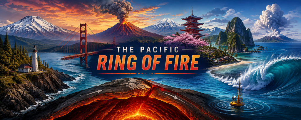
The Pacific Ring of Fire is one of those geographic names that sounds almost mythical. It brings to mind burning mountains, huge earthquakes, shattered coastlines, and distant island chains rising from a restless ocean. In reality, it is even more impressive than the name suggests. The Ring of Fire is not a single crack in Earth’s crust, nor is it a literal flaming circle around the Pacific Ocean. It is a vast, broken belt of plate boundaries, volcanic arcs, deep-sea trenches, mountain chains, and fault systems surrounding much of the Pacific Basin.
This is the part of Earth where continents are still being pushed upward, ocean floor is being dragged back into the mantle, and new volcanic landscapes are constantly being created. The Andes, the Aleutian Islands, Japan, the Philippines, New Zealand, and the Cascade Range of western North America are all tied, in different ways, to the same immense tectonic system. It is dangerous, but it is also responsible for some of the most dramatic scenery and culturally important places on the planet.
Pacific Ring of Fire: Quick Answer
The Pacific Ring of Fire is a horseshoe-shaped zone of intense volcanic and earthquake activity around much of the Pacific Ocean. It exists because several of Earth’s tectonic plates collide, slide past one another, or sink beneath one another around the Pacific Basin.
At a glance:
- It follows many of the Pacific Basin’s most active plate boundaries.
- It includes major volcanic and earthquake-prone regions in the Americas, Alaska, Japan, the Philippines, New Zealand, and parts of the southwest Pacific.
- Most of its volcanoes are linked to subduction zones, where one tectonic plate is forced beneath another.
- It is not one continuous “ring,” and not every volcano or earthquake near the Pacific belongs to the same geological setting.
- Hawaii is in the Pacific Ocean but is generally not considered part of the Ring of Fire because its volcanoes are mainly formed by a hotspot rather than a plate boundary.
The phrase “Ring of Fire” is popular rather than strictly scientific. The Smithsonian’s Global Volcanism Program notes that the region is not a single connected structure, its volcanoes do not share one magma system, and different stretches of the Pacific Rim operate under different tectonic conditions. Still, the term remains useful because it captures a real pattern: an extraordinary concentration of active volcanoes, earthquakes, trenches, and mountain-building zones around the Pacific.
What the Ring of Fire Actually Looks Like
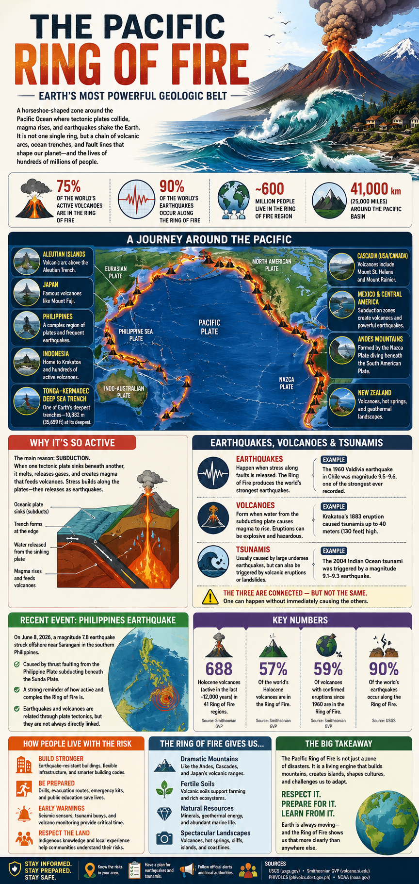
On a map, the Ring of Fire resembles an uneven horseshoe wrapped around the Pacific Ocean. It begins along the west coast of South America, runs north through Central America, Mexico, the western United States, Canada, and Alaska, then bends across the Aleutian Islands. From there, it continues through parts of eastern Russia, Japan, the Philippines, Papua New Guinea, Tonga, and New Zealand.
The “ring” is not neat or complete. Some sections are wide, fractured zones containing several active faults and volcanic chains. Others are interrupted by ocean basins, smaller tectonic plates, or regions where the geological story is more complicated than a simple map can show. The western Pacific, especially around Japan, the Philippines, Indonesia, and New Zealand, is one of the most complex places on Earth because multiple plates and microplates are moving in different directions at once.
The United States Geological Survey describes the Ring of Fire as a zone partly encircling the Pacific Basin where volcanic arcs and oceanic trenches occur together. These volcanic chains usually sit inland or landward of deep-sea trenches, revealing the hidden collision zone beneath them. The Aleutian Islands are a good example: the volcanic island chain lies parallel to the Aleutian Trench, where the Pacific Plate is being forced downward beneath part of the North American Plate.
The Engine Beneath It: Plate Tectonics
To understand the Ring of Fire, picture Earth’s outer shell as a cracked shell made of huge moving slabs called tectonic plates. These plates move slowly—often only a few centimetres per year—but their movement over millions of years reshapes continents and oceans. Where plates interact, energy builds. Sometimes that energy is released suddenly as an earthquake. In other places, the movement creates volcanoes, mountain chains, ocean trenches, or all three.
The most important process along much of the Ring of Fire is called subduction. This happens when a denser oceanic plate collides with another plate and sinks beneath it into the mantle. As the descending plate travels downward, it releases water and other materials into the hot rocks above it. That lowers the melting point of mantle rock, creating magma that can rise toward the surface.
This is why many of the Ring of Fire’s volcanoes form long chains parallel to ocean trenches. The trench marks where a plate begins descending. Farther inland, the rising magma feeds volcanoes. Over time, repeated eruptions can build volcanic islands, steep stratovolcanoes, broad mountain ranges, and fertile valleys.
Subduction zones are also capable of producing some of the world’s largest earthquakes. When two plates become locked together, they may continue trying to move while stress builds over decades or centuries. Eventually, the fault can rupture violently, causing the seafloor or land surface to shift. If the ocean floor is displaced enough, it can generate a tsunami that travels across an entire ocean basin.
Why the Ring of Fire Has So Many Volcanoes
The Ring of Fire contains a remarkable share of the world’s recent volcanic activity. The Smithsonian Global Volcanism Program identifies 688 Holocene volcanoes—volcanoes active within roughly the last 12,000 years—across 41 Pacific Ring of Fire volcanic regions. That is about 57 percent of the world total in its database. Since 1960, about 59 percent of volcanoes with confirmed eruptions have been in these regions, accounting for roughly 68 percent of confirmed eruptions worldwide.
That does not mean every volcano near the Pacific is equally dangerous or constantly erupting. Some volcanoes erupt frequently but relatively gently. Others can remain quiet for centuries before producing destructive eruptions. The danger depends on the volcano’s magma chemistry, gas content, slope, local weather, nearby rivers, population density, evacuation routes, and the type of eruption involved.
Many Ring of Fire volcanoes are stratovolcanoes, also called composite volcanoes. These are the steep, iconic mountains people often imagine when they think of volcanoes: Mount Fuji in Japan, Mount Rainier in Washington State, Mount Pinatubo in the Philippines, and Mount Ruapehu in New Zealand. Their magma is often thicker and more gas-rich than the lava associated with places such as Hawaii, which can make eruptions more explosive.
Explosive eruptions can produce ash clouds, pyroclastic flows, lahars, and dangerous volcanic gases. A pyroclastic flow is a fast-moving, ground-hugging avalanche of hot gas, ash, rock fragments, and volcanic debris. A lahar is a volcanic mudflow that can form when ash and loose debris mix with heavy rain, melted snow, or water released from a crater lake. These hazards can travel far beyond a volcano’s immediate slopes.
The Famous Places Created by the Ring of Fire
The Ring of Fire is not simply a line of danger on a map. It is a planet-scale landscape machine. Some of the world’s most recognizable mountains, islands, coastlines, and cultural landmarks exist because tectonic plates have been colliding for millions of years.
Along South America’s western edge, the Nazca Plate descends beneath the South American Plate. This long collision zone helped build the Andes, the world’s longest continental mountain range. Chile, Peru, Ecuador, Bolivia, and Argentina all contain landscapes shaped by uplift, volcanism, earthquakes, mineral deposits, and erosion connected to this tectonic boundary.
Farther north, the Cascades stretch through the Pacific Northwest of the United States and Canada. Mount St. Helens, Mount Rainier, Mount Hood, and Mount Garibaldi are all part of a volcanic arc formed as the Juan de Fuca Plate subducts beneath North America. These mountains are not ancient, dead relics. They are part of an active system that is still capable of major earthquakes and eruptions.
Japan is another classic Ring of Fire country. Its islands sit beside multiple plate boundaries, and its history, architecture, emergency planning, folklore, and infrastructure have all been shaped by frequent earthquakes and volcanic activity. Mount Fuji is both a geological feature and one of Japan’s most powerful cultural symbols, showing how a volcano can become part of a nation’s identity even while remaining potentially hazardous.
The Philippines is equally important in this story. The country is made up of thousands of islands formed and altered by volcanic activity, earthquakes, uplift, erosion, and changing sea levels. Its terrain includes active volcanoes, deep offshore trenches, rugged mountain ranges, and densely populated coastal areas—all within a complicated tectonic environment where several plates and smaller crustal blocks interact.
The Philippines and the Recent Sarangani Earthquake
Yes—the Philippines absolutely belongs in any serious discussion of the Pacific Ring of Fire. Its geological setting is complex, but it sits within one of the Pacific’s most active plate-boundary regions. The country’s earthquakes and volcanoes are tied to the movement of the Philippine Sea Plate, the Sunda Plate, the Philippine Mobile Belt, and smaller tectonic blocks in the area.
A recent example came on June 8, 2026, Philippine local time, when a magnitude 7.8 earthquake occurred offshore near Sarangani in the southern Philippines. The USGS reported that the earthquake resulted from thrust faulting within a complex active-deformation zone associated with the westward subduction of the Philippine Plate beneath the Sunda Plate. That makes it directly relevant to the Ring of Fire story—not because every quake in the region is caused by one simple “ring,” but because it reflects the same powerful collision and subduction processes that define much of the Pacific Rim.
This is an important distinction. A major earthquake in the Philippines is not automatically linked to a volcanic eruption, and an earthquake does not mean a nearby volcano is about to erupt. Earthquakes and volcanoes can share a tectonic setting without being immediate cause-and-effect events. The Ring of Fire is best understood as a connected zone of geological forces, not as a chain reaction where one disaster triggers the next around the Pacific.
The Philippines also demonstrates why “living near danger” is only part of the story. Volcanic soils can support productive agriculture. Mountain landscapes shape watersheds, forests, and settlement patterns. Coastal areas support fisheries, shipping, and trade. People do not live in these regions because they ignore the risk; they live there because tectonically active landscapes can also be fertile, beautiful, resource-rich, and historically important.
Earthquakes, Volcanoes, and Tsunamis: Related but Not Identical
The Ring of Fire often gets described as a place of earthquakes, volcanoes, and tsunamis, which is true—but the three hazards should not be treated as identical. They are connected through plate tectonics, yet each has its own warning signs, timing, and risks.
Earthquakes happen when stress is released along a fault. Some are shallow and damaging near cities; others occur deep underground and may be felt over a wide area but cause less surface destruction. Volcanic eruptions occur when magma, gas, and pressure find a route to the surface. Tsunamis usually result from sudden displacement of seawater, most often caused by undersea earthquakes but sometimes by volcanic eruptions, submarine landslides, or coastal landslides.
A few practical distinctions matter:
- A powerful earthquake can occur without causing a tsunami.
- A volcanic eruption can occur without a major earthquake.
- A tsunami can cross an ocean basin and strike coastlines far from the original earthquake.
- Not all Pacific coastlines face equal tsunami risk; local seafloor shape, coastline geometry, and the direction of rupture all matter.
- A sudden retreat of seawater can be a natural tsunami warning sign, but official emergency alerts and evacuation instructions should always take priority.
The 1883 eruption of Krakatau in Indonesia is one of history’s most famous volcanic-tsunami disasters. The collapse and explosive activity around the volcano generated devastating waves that struck coastal communities in Java and Sumatra. It remains a reminder that volcanic regions can create hazards well beyond lava flows and ashfall.
How People Live Along Earth’s Most Restless Coastline
Millions of people live within the broader Ring of Fire region. Cities such as Tokyo, Manila, Santiago, Seattle, Vancouver, Auckland, and Wellington are connected to tectonically active landscapes in different ways. The goal is not to “defeat” geology. It is to reduce avoidable risk through better buildings, public education, early-warning systems, emergency planning, hazard maps, and smart land-use decisions.
Japan is widely known for earthquake-resilient engineering, public drills, and warning systems. Chile has developed extensive earthquake and tsunami awareness after repeated major events along its coast. The Philippines operates through agencies such as PHIVOLCS, which monitors earthquakes, volcanoes, and tsunami hazards while providing public advisories and hazard information.
Preparation matters because the earliest moments of an earthquake or tsunami warning can be chaotic. Stronger construction standards, well-rehearsed evacuation routes, public communication, and realistic household emergency plans can make a major difference. These measures do not eliminate risk, but they can reduce casualties and help communities recover faster after a disaster.
There is also a human tendency to focus only on catastrophe. That misses half the story. Volcanic landscapes can create fertile farmland, dramatic tourism destinations, geothermal energy potential, mineral resources, natural harbours, and striking cultural landscapes. The same forces that make a place dangerous can also make it economically and historically important.
Why the Ring of Fire Matters
The Pacific Ring of Fire matters because it reveals that Earth is not finished. The continents and oceans we see on a map are not permanent fixtures. Mountain ranges rise, islands appear, coastlines shift, trenches deepen, and old land is recycled into the mantle. The Pacific Rim is one of the clearest places to see that process in action.
It also matters because the Ring of Fire is home to hundreds of millions of people. It is not an empty wilderness belt where geological forces play out far from civilization. It includes some of the world’s largest cities, busiest ports, most productive agricultural areas, and most memorable travel destinations. Understanding it is not just a science lesson—it is part of understanding why these places look the way they do and why their people have adapted in such specific ways.
The phrase “Ring of Fire” can make the Pacific sound like a single giant danger zone. The truth is more interesting. It is a patchwork of geological systems, each with its own faults, trenches, volcanoes, history, and hazards. Yet taken together, those systems form one of Earth’s greatest stories: a restless edge where the planet breaks, rebuilds, and creates landscapes that have shaped human history for thousands of years.
Related External Links
- U.S. Geological Survey: The Ring of Fire — A clear official overview and map explaining the volcanic arcs and ocean trenches around the Pacific Basin.
- PHIVOLCS: June 2026 Offshore Sarangani Earthquake Primer — Official Philippine earthquake information and context for the recent Sarangani event.