The moment you hit rock
Northern Ontario has a tell. You can feel it as the highway rolls from soft farm country into harder, older ground, and you can see it in roadside cuts where gray granite shows through the moss. But the clearest proof is simple: try to dig. In much of the north, you don’t excavate deep soil for long before you strike bedrock.
That “thunk” is the Canadian Shield making an introduction. It’s an ancient crust of granite and metamorphic rock that underlies most of the province north of the Great Lakes–St. Lawrence lowlands. It’s the reason Northern Ontario looks like a patchwork of forest, exposed stone, and water, and it’s the reason settlement, roads, and industry feel different up here than they do around the Golden Horseshoe.
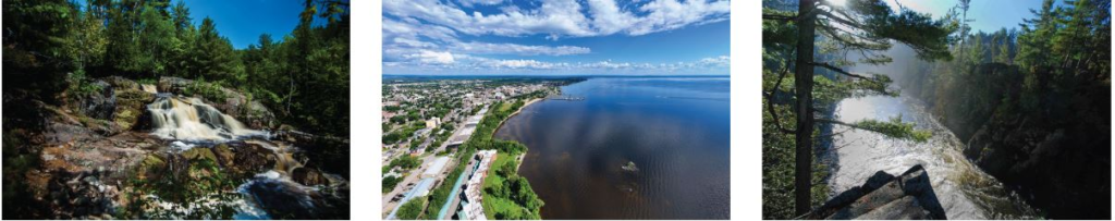
This article stays Ontario-only on purpose. We’re trekking from the Shield’s southern gateway towns—North Bay and Sudbury—through the mining belt around Timmins, across the Lake Superior edge at Thunder Bay, and up toward the James Bay coast where sea ice changes the rules of travel.
Where the Canadian Shield begins in Ontario
If you picture the Shield as “far north,” you’re half right. It is far north, but it also begins surprisingly close to the south. As you move north from deep agricultural soils, the ground transitions into thin glacial deposits and exposed rock. In practical terms, that transition becomes obvious around North Bay and Sudbury, where the Shield dominates the landscape.
These rocks can be billions of years old, and their age matters because it explains two things travelers notice immediately: ruggedness and water. Ice Age glaciers scraped away soils and carved the surface, then left countless depressions that filled with meltwater. That is why Northern Ontario is a lake country in the most literal sense.
So the Shield isn’t merely “rocky terrain.” It’s a land molded into lakes, rivers, ridges, and wetlands. Once you see it that way, Northern Ontario stops looking empty and starts looking designed by geology.
Glaciers made the lakes, but the lakes made the culture
Northern Ontario’s lakes are not a footnote. Water is why the land feels both accessible and inaccessible at the same time. A canoe can move through routes that would be brutally expensive to build as roads, and for thousands of years water was the transportation network that mattered most.
The lake density also creates a particular kind of wilderness. You get long sightlines across open water, then immediate enclosure as you re-enter spruce and pine forest. You get rocky shorelines ideal for campsites, and islands that feel private even when civilization isn’t far away.
And yes, the fishing can be exceptional. Walleye, northern pike, lake trout, and smallmouth bass thrive in many Shield systems because the water tends to be cold, oxygen-rich, and structurally complex. The limiting factor isn’t “too cold to fish.” The limiting factor is access and distance.
Building on bedrock: costly to start, solid once you’re there
You asked a sharp question: if it’s hard to dig, doesn’t bedrock give you a better foundation? In many cases, yes. A building anchored to bedrock can be extremely stable. Frost heave can be less disruptive when a structure is tied into rock rather than sitting on shifting soil.
The problem is not whether a single home can be built. People build cabins, cottages, and sizable houses on the Shield all the time. The problem is whether a whole town can be expanded cheaply. Once you scale up to streets, water lines, sewer lines, and utilities, “bedrock everywhere” becomes a cost multiplier.
So the Shield doesn’t prevent building. It prevents cheap, fast sprawl. That one difference explains a lot about why Ontario’s population concentrated in the south while the north remained comparatively open.
Highway 11: Ontario’s long northern spine
Ontario Highway 11 is one of the province’s defining routes. It links the south to North Bay, continues north and west toward Temiskaming Shores and Timmins, pushes on to communities like Hearst, and connects into the Thunder Bay region.
Highway 11 is a lifeline in winter. Snowfall, drifting, freezing rain, and long stretches between services make preparedness part of the deal. Winter tires, an emergency kit, and a realistic fuel plan aren’t paranoia—they’re basic respect for distance.
The highway also marks a boundary. Beyond the main corridor, Northern Ontario doesn’t become “nothing,” but it does become different: fewer towns, more resource roads, and more places where rail or air travel is the practical access.
A practical travel rhythm: how to think about distances
One of the biggest mistakes southern travelers make is planning Northern Ontario like southern Ontario. In the south, services are frequent and detours are easy. In the north, you plan around distance, fuel, daylight, and weather. A “short” drive on a map can feel long when the road is single-lane each way, when wildlife crossings are common, and when snow reduces speed.
This isn’t meant to scare people off. It’s meant to set expectations so the trek feels like an adventure rather than a surprise. Northern Ontario rewards the traveler who leaves buffer time, carries water and snacks, and treats the route itself as part of the destination.
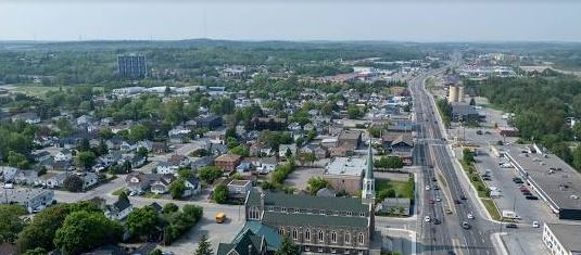
North Bay: the gateway where landscapes change
North Bay sits at a pivot point. It’s where many travelers feel they’ve crossed into the north, even though the province’s true northern frontier is far beyond. Its position near Lake Nipissing and its rail and highway connections made it a natural hub for movement, supplies, and services.
For a travel map, North Bay is also a decision point. From here you can go west toward Sudbury, north toward Timmins, or deeper into lake country that feels increasingly rugged. It’s an easy place to explain the Shield to readers because you can watch the landscape change in real time.
Sudbury: the city built on a crater of nickel
Sudbury is a reminder that the Shield isn’t only wilderness—it’s wealth. The Sudbury Basin is among the world’s best-known nickel regions, widely linked to ancient impact geology and later metal-rich processes. Whatever route you take through the science, the outcome is simple: mining made building worth it.
Where bedrock makes roads and pipes expensive, ore makes them valuable. Sudbury grew because the rock beneath it offered something the world demanded, and that demand created industry, rail links, and a city.
For visitors, Sudbury is also an interpretive stop. It helps people understand why Northern Ontario has “nodes” of settlement separated by vast stretches of forest.
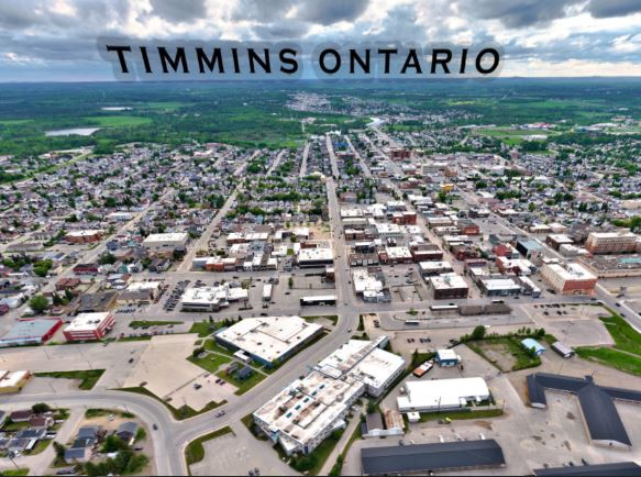
Timmins: why this town exists where it does
Timmins rose with gold. It sits within productive geological belts that host gold deposits, and those discoveries drew people and infrastructure into a landscape that otherwise would have remained sparsely settled.
Was Timmins easier to build than the surrounding forest? Not really. The ease came from economics, not terrain. When a region produces high-value minerals, governments and companies are willing to push roads, power, and services through difficult ground.
This explains the rhythm of Northern Ontario: dense pockets of development where the reasons are, and long quiet distances between them.
Why the north has so many lakes but so little farmland
Southern Ontario’s deep soils and longer growing season support large-scale agriculture. In much of Northern Ontario, thin and acidic soils, exposed bedrock, and wetlands limit that kind of farming. Even where soil exists, it’s often patchy, interrupted by rock ridges and water.
Climate amplifies the constraint. Growing seasons shorten as you move north, and spring and fall can arrive abruptly. Agriculture isn’t impossible, but the landscape doesn’t readily support the broad, high-yield fields that feed dense population centers.
So northern communities tend to rely on other anchors—mining, forestry, hydro, transport, and public services. The result is a north that feels purposeful rather than sprawling.
The boreal forest: the living roof of the Shield
Most of Northern Ontario is wrapped in boreal forest, a band of conifers and hardy mixed woods that stretches across Canada. Black spruce, white spruce, jack pine, balsam fir, birch, and poplar dominate depending on soil, fire history, and drainage. The forest looks uniform from far away, but up close it’s a patchwork of wet pockets, rocky ridges, burn scars, and regenerating stands.
Fire is part of the boreal system, not a mistake. Many species are adapted to it, and cycles of burn and regrowth help explain why some areas look young while others feel ancient. For travelers, the boreal forest is one reason the north feels bigger than your expectations: it doesn’t open into farmland. It keeps going, and going, until you reach water or rock or sky.
Lake Nipigon: inland scale, northern character
Lake Nipigon is big enough to reset your sense of distance. Cold, deep, and northern in temperament, it drains into Lake Superior through the Nipigon River system. It supports cold-water fisheries and sits in a landscape that still looks like the Ice Age just passed through.
As a destination, Lake Nipigon also shows the Shield’s paradox: enormous freshwater abundance paired with sparse settlement. You can have a lake this large and still be far from the infrastructure you’d expect around big water in the south.
Thunder Bay: the Lake Superior edge of the north
Thunder Bay sits on Lake Superior, and Lake Superior behaves like a weather machine. Storms can roll in fast, winds can bite, and winter can feel long along the lake’s margins. The Sleeping Giant formation rising above the water is a reminder that geology is never far from the surface here.
Thunder Bay matters because it is a major northern hub. It connects roads and rail, supports logistics, and serves as a base for exploring the Lake Superior shoreline and the broader northwest. If Ontario’s northern development thickens in the future, it will likely do so through established hubs like Thunder Bay rather than through brand-new cities in remote muskeg.
Lake Superior’s weather and the Thunder Bay–Nipigon corridor
If you’ve ever driven the Lake Superior edge, you know the lake sets the tone. Cold water moderates summer heat but can also feed fog, sudden winds, and big storms. In winter, Superior’s influence contributes to heavy snow in certain setups, and the shoreline can feel like a different climate than the interior only a short distance away.
This is why Thunder Bay feels like a logical base camp. From here you can experience a northern city, but you’re also close to dramatic coastline and the kind of rugged rock-and-water scenery that defines the Shield at its most cinematic. The drive toward Nipigon and inland toward Lake Nipigon feels like entering the heart of northern scale.
Rivers before highways: the north’s original network
Before Highway 11, before rail, and certainly before modern air travel, rivers were the north’s connectors. Canoe routes, portages, and water highways shaped movement and trade. If you want to understand Northern Ontario historically, follow the water.
The Moose River system is a prime example. Flowing toward James Bay, it connected interior regions to coastal trade networks. Even today, rivers remain ecological corridors and cultural memory, showing how people moved through a land where building roads was never the simplest option.
Indigenous routes and place memory in Ontario
Long before highways, Indigenous peoples moved through Northern Ontario by water and portage. The Shield’s lakes and rivers weren’t obstacles; they were corridors. Those routes shaped trade, seasonal movement, and community connections, and later they influenced where European fur trade posts and transport lines appeared.
You don’t need to list every route to respect this history. It’s enough to explain the logic: the Shield is navigable by water in ways it is not easily navigable by road, and that reality produced a travel culture built around canoes, portages, and knowledge of the land. Even today, the north’s geography still favors certain paths, which is why rail and air remain practical in parts of the province.
Moose River, Moosonee, and the James Bay lowlands
The Moose River drains into the James Bay lowlands, where the landscape becomes flatter, wetter, and more subarctic in feel. Moosonee sits near the coast and is famously reachable by rail rather than road, a detail that perfectly captures the north’s logistical character.
In this region, the “brown pockets” you noticed on maps are often wetlands and peatlands—muskeg that holds immense ecological value but offers poor ground for conventional construction. Muskeg is saturated and unstable for heavy loads unless engineered carefully, which raises costs and limits sprawl.
This is why the James Bay coast feels like a threshold. South of it, ridges and lakes dominate. Near the bay, wetland systems expand, trees thin, and the climate presses harder.
Subarctic Ontario: colder, windier, shorter summers
Subarctic doesn’t mean instant tundra, but it does mean long winters, shorter summers, and fewer frost-free days. Snow cover lasts longer, and freeze-up and break-up define the calendar. Compared to Ottawa, the James Bay region has fewer warm days and more persistent cold, plus wind exposure that can make the same temperature feel sharper.
The consequence is practical. Short seasons and challenging ground make dense settlement and farming harder, and supply chains must work around weather windows. This is a climate that selects for resilience, not convenience.
Polar Bear Provincial Park and the frozen bay
Polar Bear Provincial Park lies along Ontario’s far northern coast, where the land meets Hudson Bay and James Bay. Polar bears use the coastal zone and sea ice seasonally, and the bay system shapes wildlife movement across the region.
The bay freezes seasonally, generally from late fall into late spring, though the exact timing varies by year. The presence of sea ice shapes everything from animal behavior to human logistics, and it’s one of the reasons Ontario’s far north feels closer to the Arctic than most people imagine.
Winnisk River Provincial Park and what “remote” means
Winnisk River Provincial Park represents deep northern wilderness. This is Ontario where roads do not neatly reach everything, and where rivers and air travel can be the practical access points. It’s boreal forest, water, and distance, with the kind of silence that feels rare in a province known for its busy south.
Including places like Winnisk River reminds readers that Northern Ontario isn’t only a string of towns along a highway. It’s a vast interior with protected areas and ecological zones that remain largely intact.
Sandy Lake and fly-in Ontario
Sandy Lake highlights a reality many southerners forget: parts of Ontario are not road-connected year-round. Fly-in communities and seasonal winter roads are still part of provincial geography. This isn’t a sign of neglect so much as the consequence of wetlands, rivers, and cost.
For travelers, it’s also a reminder that the “north” is a gradient. Highway towns are one layer. True remoteness is another.
Resources: mapped, but not “solved”
Northern Ontario has been heavily mapped geologically, and modern exploration uses airborne surveys, sampling, and drilling to identify mineral potential. But mapping is not development. Exploration requires permits, expertise, and money, and development requires infrastructure, environmental review, and partnership agreements.
A deposit can exist and still be uneconomic without roads, power, processing capacity, and favorable markets. The Shield is full of potential, but potential only becomes production when conditions line up.
The future: selective growth, not blanket sprawl
If Ontario expands northward, it will likely do so selectively. Existing hubs and corridors—North Bay, Sudbury, Timmins, and Thunder Bay—have the services and transport links that make growth plausible. In contrast, broad urban sprawl across rock ridges and muskeg is unlikely to be cheap or fast.
Critical mineral demand could intensify investment and infrastructure in specific regions. But even then, the Shield will continue to dictate where expansion makes sense and where wilderness remains the default.
Why Northern Ontario stayed vast, and why that’s the point
Northern Ontario is vast because geology, climate, and economics intersect in ways that resist dense settlement. The Shield dictates where roads go, where cities rise, and where wilderness remains. Wetlands complicate construction, and long winters shorten the kind of seasons that support southern-style sprawl.
But that resistance is not weakness. It is identity. It’s the reason Ontario still contains landscapes that feel genuinely immense—places where you can drive for long stretches with nothing but forest, rock, and sky.
The north feels powerful because it is anchored to stone that predates complex life on Earth. It feels wild because glaciers sculpted it rather than plows. And it feels worth trekking because it reminds you what scale looks like when nature sets the terms.